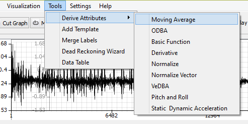
A number of typical statistical measures and attributes can be derived using our built-in data processors. These are accessible through a single click in the menu bar.
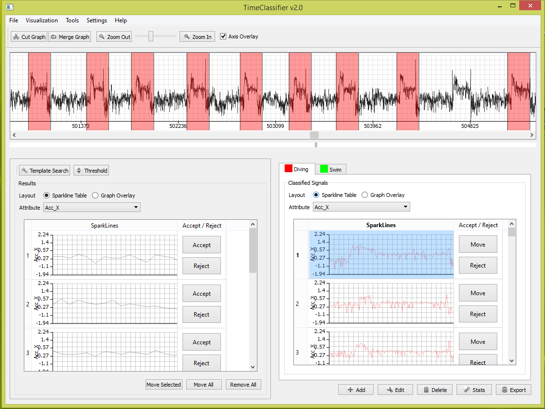
Our interface is purpose built for the labelling of animal behaviour and patterns of interest. The user can manually drag and drop segments of data to behavior groups in the software. This is complemented with a search function which allows the user to search for all instances of a given behavior signal. Unlike traditional data mining methods our software allows the user to verify and correct results within the software. This means 100% precision and recall can be achieved.
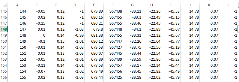
Derived attributes can be outputted together into one data file in CSV format, where the attributes are appended as additional columns in the data file alongside existing data channels. This allows further analysis outside of Framework4.
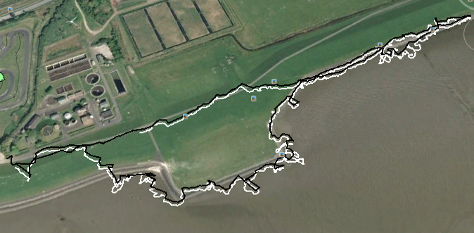
Dead reckoning utilises the accelerometer and magnetometer channels to resolve fine-scale animal movement at infra-second scales. This operates on the basis that the position of an animal at any time can be derived knowing the position of the animal at the previous time given a heading and distance. We provide a user-friendly wizard which encompasses state-of-the-art methods for dead reckoning.
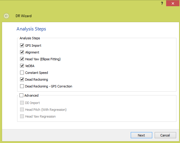
Dead reckoning alone is sensitive to accumulative errors over time. GPS correction functionality allows the user to correct the headings and speed obtained via dead reckoning to be alligned with GPS positioning information. This resets the error at each GPS fix. The results is a method which utilises the accuracy of GPS integrated with the fine-scale dead reckoned trajectory's.
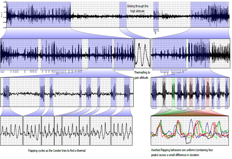
Visualization is key to gaining knowledge and insight into data. We include innovative state of the art visualisations to allow the exploration, analysis and presentation of smart sensor data.